Skip to content
OlaSailSearch
Island in Central Dalmatia

Vis island by boat

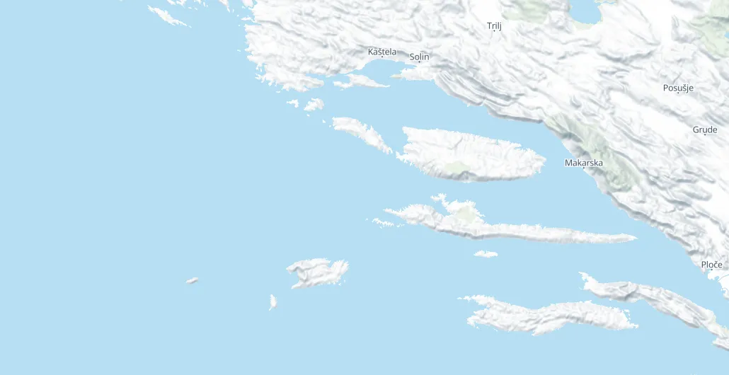
Vis is an island across an open channel from Split and Hvar, with two harbour towns, Vis and Komiža, and buoy fields at Stončica, Rukavac and Budikovac. Plan two nights or more, because the crossing each way takes about half a day.

30 NMfrom Split, about 5 h (Measured by us, )
15 NMfrom Hvar town, about 2½ h (Measured by us, )
June, Septhe best months
8places to stay the night
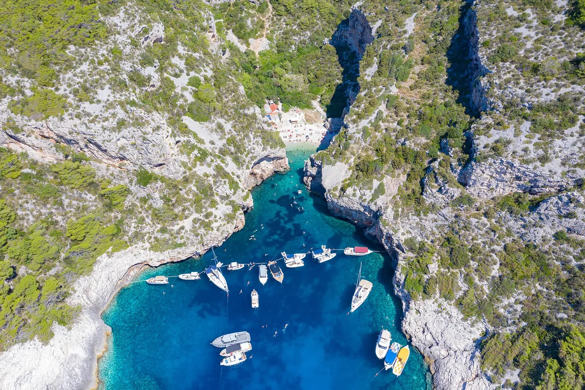
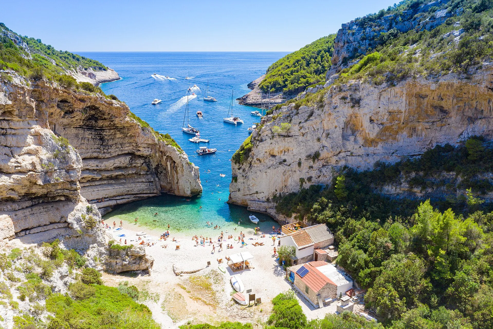
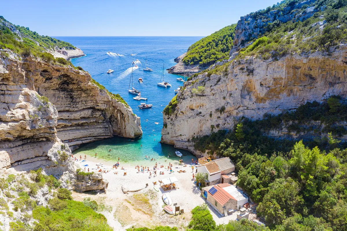
Sailing yachts anchored off the mouth of Stiniva cove, aerial with open sea and horizonPhoto: “Aerial view of the Adriatic Sea at Stiniva Bay on Vis island in Croatia” by dronepicr, CC BY 2.0, cropped and resized
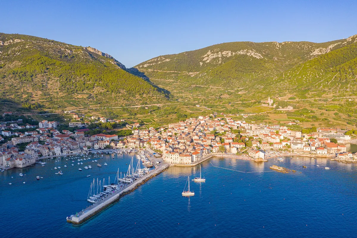
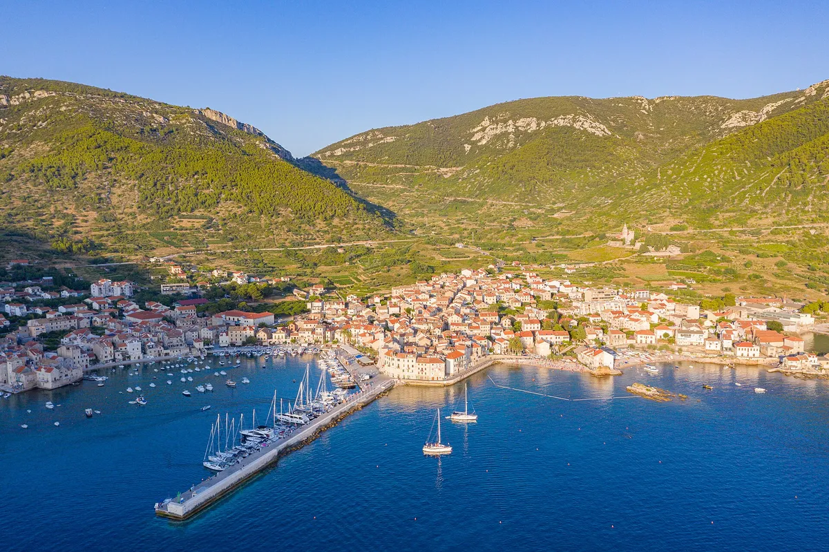
Aerial of Komiža harbour and town, yachts on the pier and at anchor, hills behindPhoto: “Aerial view of Komiza Town Harbour on Vis island, Croatia” by dronepicr, CC BY 2.0, cropped and resized
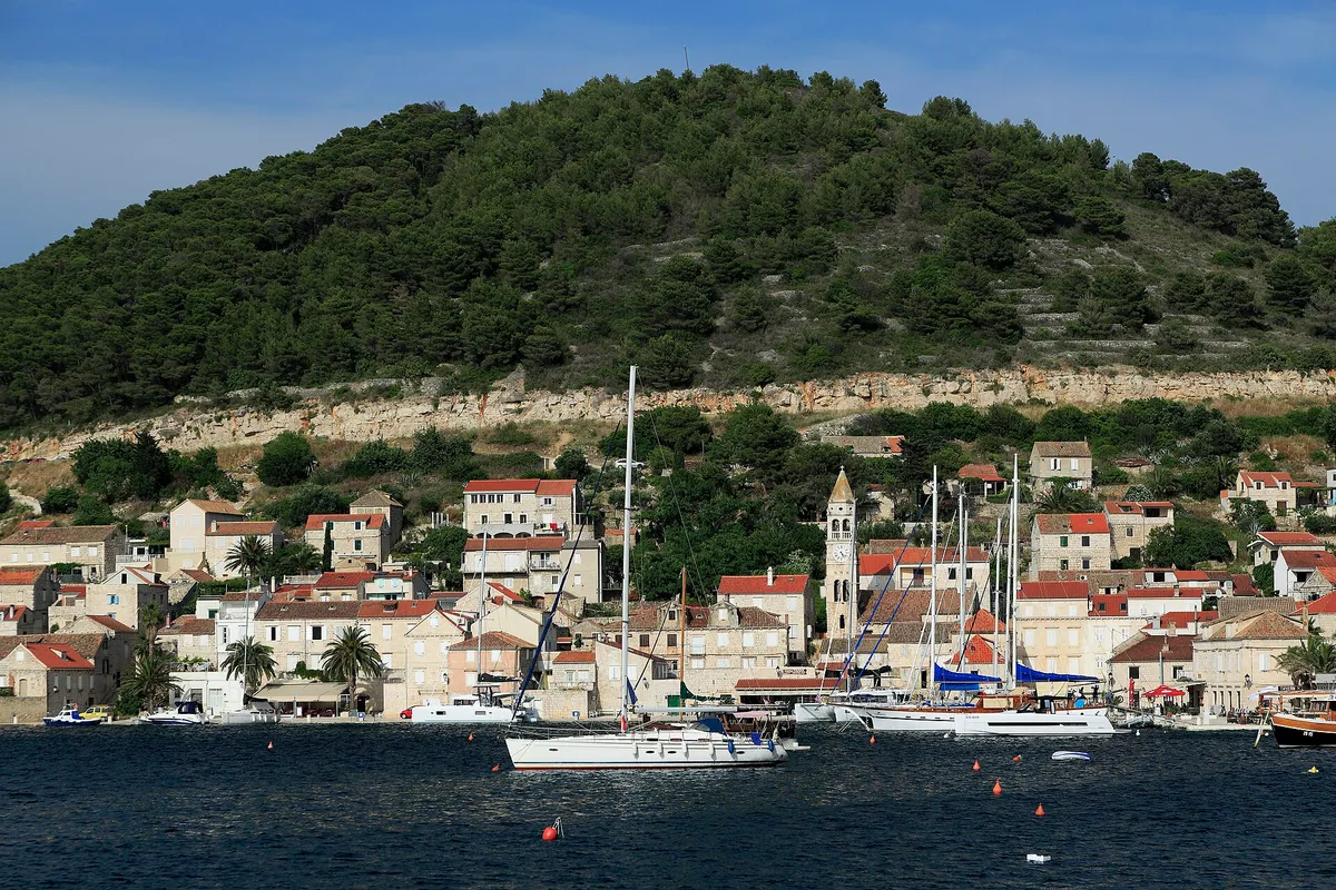
Kut waterfront in Vis town with yachts and gulets moored and a yacht on a buoy in frontPhoto: “J32 421 Vis-Stadt, Lučica” by Falk2, CC BY-SA 4.0, resized

Written by Domagoj Franc, editor. Reviewed by Ivor Benko, skipper.

Published .

All 76 facts on this page name their source, the latest checked on : 26 from the operator, 21 from official sources, 11 measured by us and 16 from third-party sources, such as pilot books and magazines, so treat those 16 as a guide. The sources disagree on one point, in 2 facts: shelter.

See every source

Vis has no area steward yet. Sail here every season? Become the area steward.

Where to spend the night on Vis

8 places to stay the night. Prices are for a 12 m boat in 2026. Shelter lines name the local winds: the jugo blows from the southeast and the bura from the northeast. What each wind does. Our cautious answer: weather descriptions, not a forecast: read DHMZ's forecast for sailors before you go. Our skipper reviewer hasn't checked this yet.

Open to wind and swellSome swellShelteredNorth is up
Not for navigation

Every place to stay on Vis, at a glance

The price of a night for a 12 m boat in 2026, as each place's card gives it, and who to call.

PlaceKindA night, 12 m boatContact
Kut waterfront in Vis town with yachts and gulets moored and a yacht on a buoy in frontVis town harbourQuay€119.15 (Measured by us, )+385 21 718 746 (From the operator, )
Aerial of Komiža harbour and town, yachts on the pier and at anchor, hills behindKomižaQuay€60 (Official source, )+385 21 713 085 (Official source, )Harbourmaster, Wednesdays
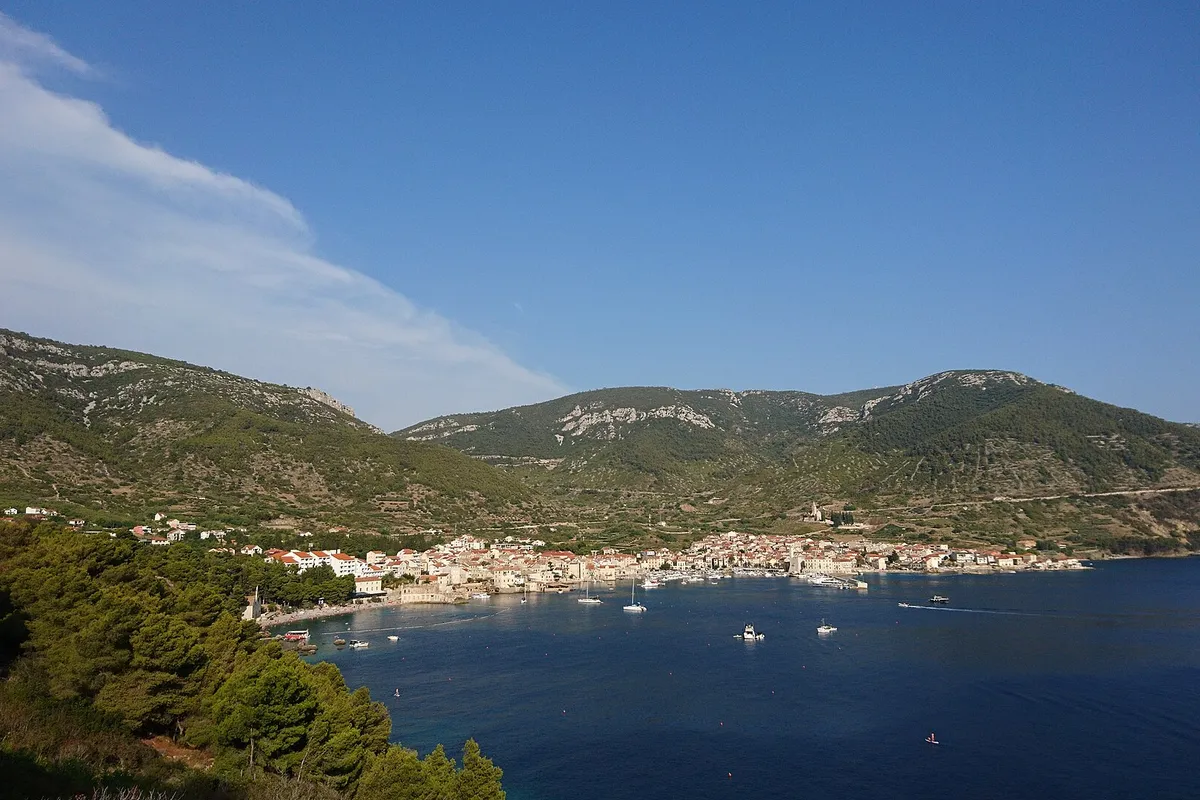
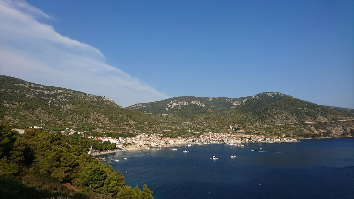
Komiža bay from the hillside, with boats at anchor in front of the town and the Hum hills behind.Komiža buoysBuoysUnknownTell us about the buoy price in 2026 at KomižaNot listed yet
Yachts on mooring buoys in Stončica bay, with the beach and pine slope, seen from the hillsideStončicaBuoysUnknownTell us about the buoy price at Stončica+385 21 711 121 (From the operator, )
Small local boats in the clear turquoise bay at RukavacRukavacBuoys€60 (From the operator, )Not listed yet
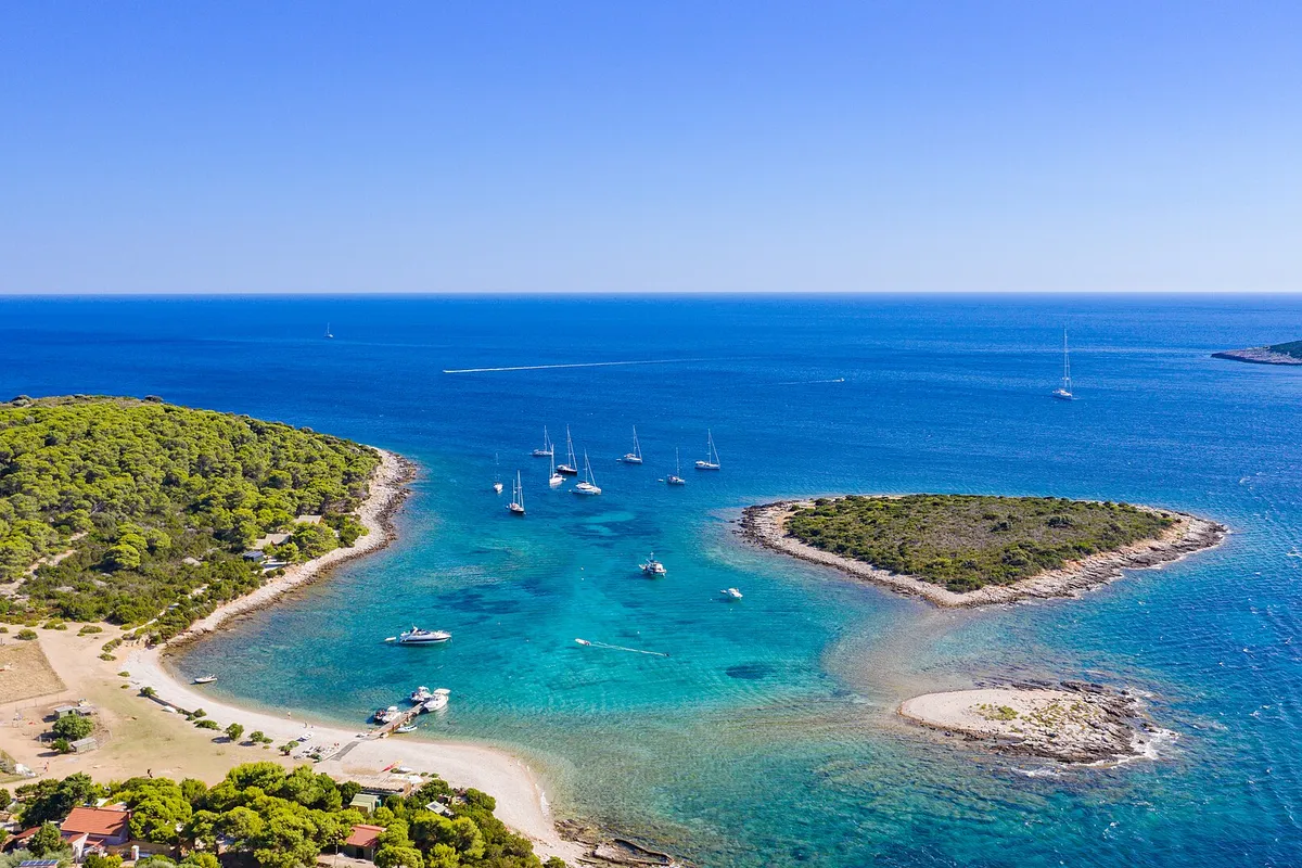
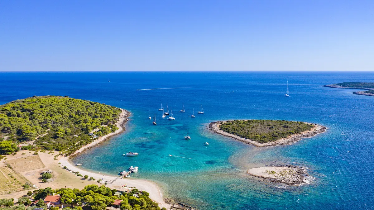
The lagoon between Veli Budikovac and Mali Budikovac from the air, yachts on the buoys in turquoise water, the pebble beach and the jetty on Veli Budikovac and open sea beyondBudikovacBuoys€60 (From the operator, )Not listed yet
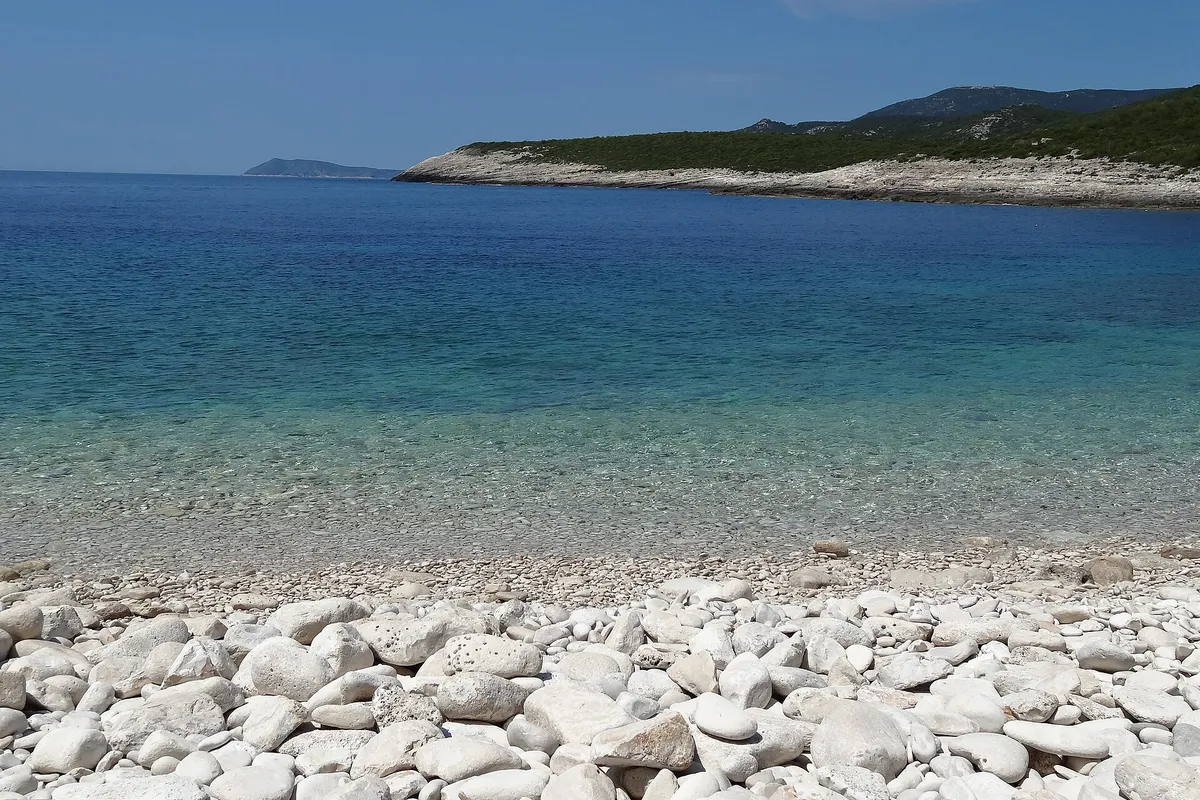
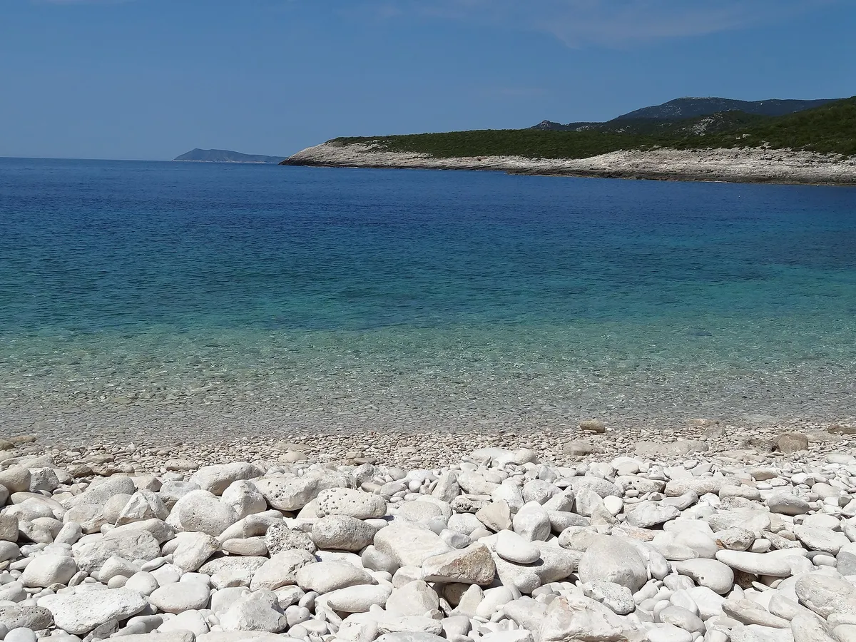
The white pebble beach of Srebrna bay with clear shallow water, the low rock slabs of the headland and open sea beyondSrebrnaAnchorageNo concession (Official source, )Not listed yet
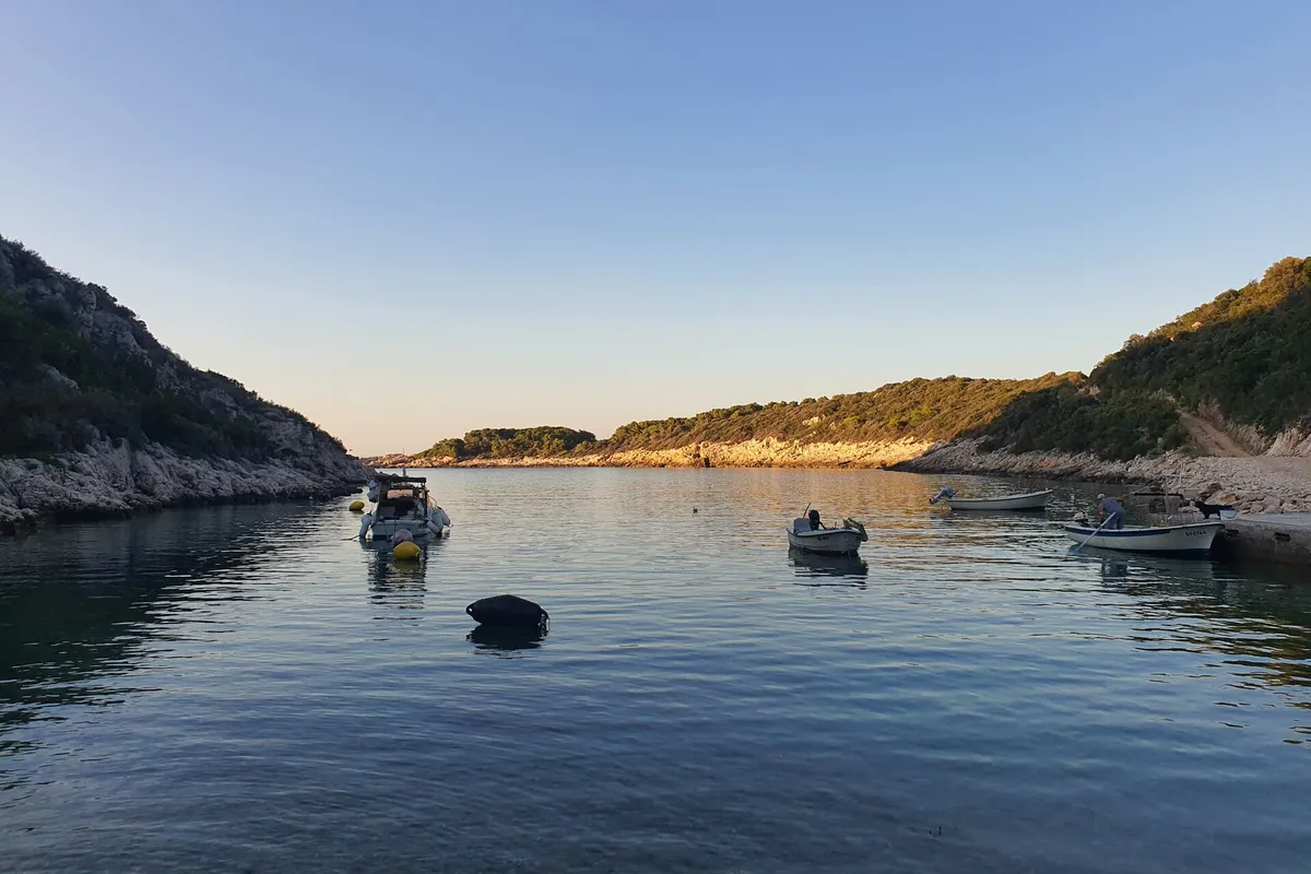
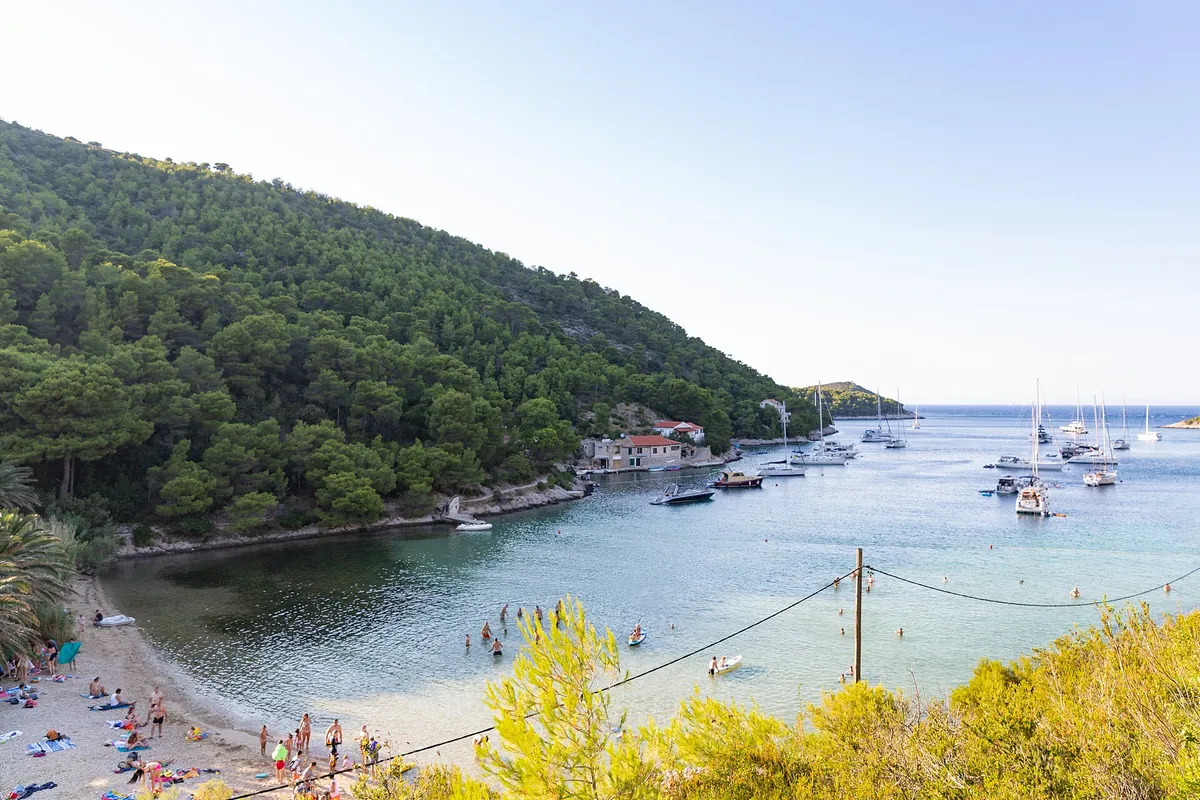
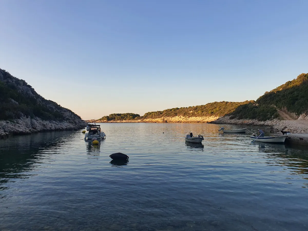
Oključna bay on Vis at dusk, small boats on their moorings in calm water between rocky wooded slopes, the evening sun on the far shoreOključnaAnchorageNot listed yetNot listed yet

Wind and shelter on Vis

The three summer winds, and which harbours each one reaches. Check the forecast before you pick a night, and our guide to the winds for which forecast to trust.

Maestralfrom the northwest

The afternoon sea breeze in summer. Good sailing.

Exposed
Vis town, the Kut side (Third-party source, ); Komiža, the buoys (Third-party source, ); and Komiža bay (Third-party source, )
Some swell
Budikovac (Official source, ) and Oključna (Third-party source, )
Gusty
Vis town, the main quay (Third-party source, )
Sheltered
Komiža, the berths inside the breakwater (Third-party source, ); Stončica (From the operator, ); Rukavac (Third-party source, ); and Srebrna (Official source, )

Jugofrom the southeast

A warm, wet wind that brings swell.

Exposed
Vis town, the Kut side (Third-party source, ); Vis town, the main quay (Third-party source, ); Komiža, the buoys (Third-party source, ); Komiža bay (Third-party source, ); Rukavac (Third-party source, ); and Budikovac (Official source, )
Some swell
Stončica (Official source, ) and Srebrna (Official source, )
Sheltered
Komiža, the berths inside the breakwater (Third-party source, )

Burafrom the northeast

Cold, dry and gusty. It can arrive with little warning.

Exposed
Vis town, the Kut side (Third-party source, ); Vis town, the main quay (Third-party source, ); Komiža bay (Third-party source, ); Stončica (Official source, ); Budikovac (Official source, ); and Oključna (Third-party source, )
Gusty
Komiža, the buoys (Third-party source, )
Sheltered
Komiža, the berths inside the breakwater (Third-party source, ); Rukavac (Third-party source, ); and Srebrna (Official source, )

How often each wind blows: From April to October, maestral on about two afternoons in five, and on more than half in July; jugo on about one day in five; bura on about one day in ten (Measured by us, )

Wind and sea, next 3 days

For Vis town harbour.

Model forecast from Open-Meteo.Not an official forecast. Not for navigation.

Official forecast: DHMZ marine forecast (Official source, )

How to read this forecast

Each part of the day shows its strongest hourly wind and gust, and its highest wave, in Croatian time. The words follow the Beaufort scale, and the model can't tell a real bura from any other northeast wind. How to read a model forecast

Weather data by Open-Meteo.com, CC BY 4.0. Grouped into parts of the day by OlaSail.

Swim stops on Vis by boat

Day stops for a swim or lunch, most of them on the south coast near Rukavac. Our swim and lunch stops on a week from Split fits them into the route. No anchoring within 150 m of a natural beach, under the 2025 ordinance. (Official source, ) Anchoring near beaches

Yachts and motorboats anchored inside Stiniva cove, straight-down aerialPhoto: “Luftbild von der Bucht Stiniva auf der Insel Vis in Kroatien” by dronepicr, CC BY 2.0, cropped and resized

Stiniva cove

A pebble beach behind a narrow gap in the cliffs, 2.5 NM from Rukavac (Measured by us, )

How to stop
In summer a line of floats is laid across the cove. It protects the swimmers and keeps small boats out of the cove. (Official source, ) Stop outside the mouth and swim in.
Fee
No concession for the proposed buoy field had been granted by 26 Sep 2026: the county's concession map shows no concession of any kind within 4.7 km of the cove. (Official source, ) Who may charge you
Busy
In summer many small boats and yachts anchor or tie up right at the mouth of the cove. (Official source, )
Rules it out
Anchoring in the cove isn't recommended. It is deep, and southerly winds send a strong surge into it. The cliffs block some of the bura, but it comes in strong gusts that can drag an anchor. (Official source, )

Budikovac and its lagoon

Shallow turquoise water between two islets, 1.3 NM from Rukavac (Measured by us, )

How to stop
Come into the lagoon only from the south, between Mali Budikovac and Veli Budikovac, and keep closer to Mali Budikovac: shallow rocks run out from Veli Budikovac. (Official source, )The buoy field lies inside the lagoon, on shallow ground to 5 m, for boats up to 12 m. Gradina Vis's rules forbid swimming and diving in the buoy field, and anchoring anywhere it hasn't marked. Enter from the south, closer to Mali Budikovac: the shallow passage past Sanak isn't navigable. (From the operator, )
Fee
€60 a day on a buoy in 2026, VAT included, paid in cash when you arrive. (From the operator, ) Keep out of the buoy field to swim. The buoys
Busy
Vis Rent’s round-the-island tours leave Vis town at 09:00 and 14:00 and include Budikovac Lagoon. The operator gives no arrival time there. (From the operator, )
Rules it out
Budikovac is open to southerly, south-easterly and south-westerly winds, which bring bigger waves, and a storm jugo sends a surge in; the 2024 plan expects a rougher sea in a bura. The 2019 study calls it sheltered from the maestral. (Official source, )
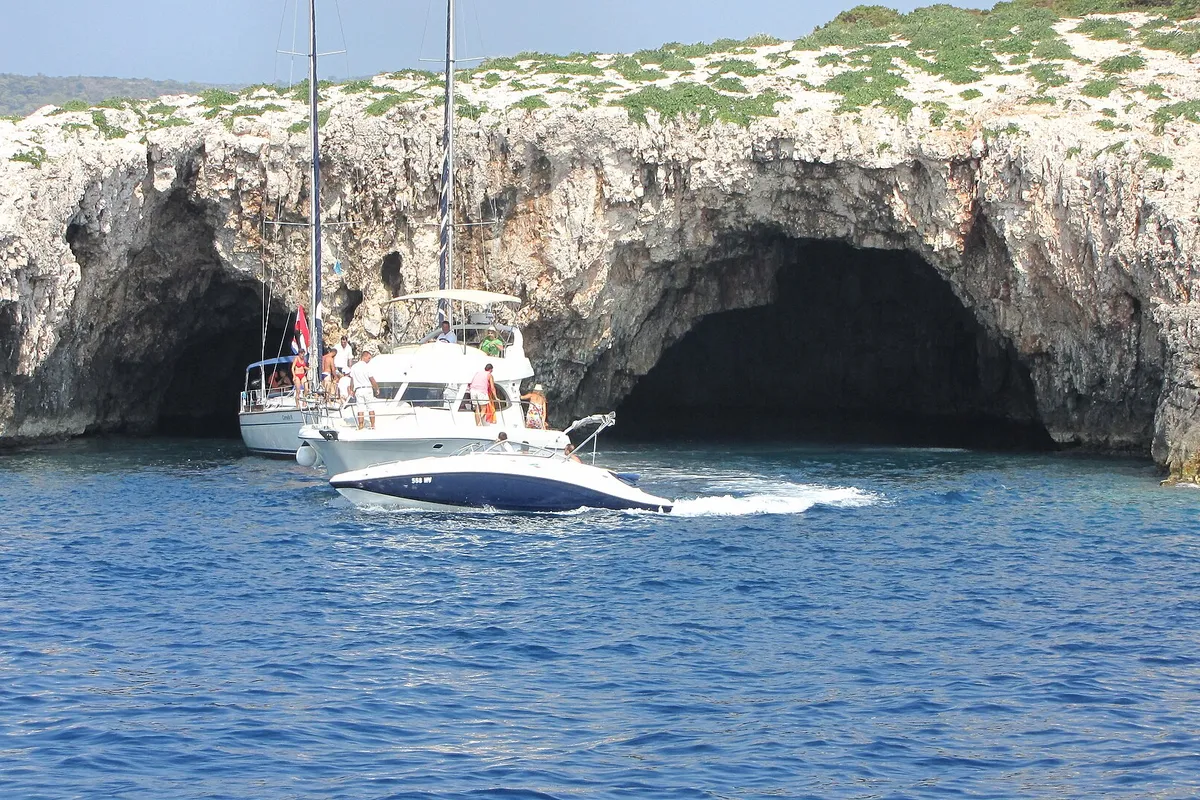
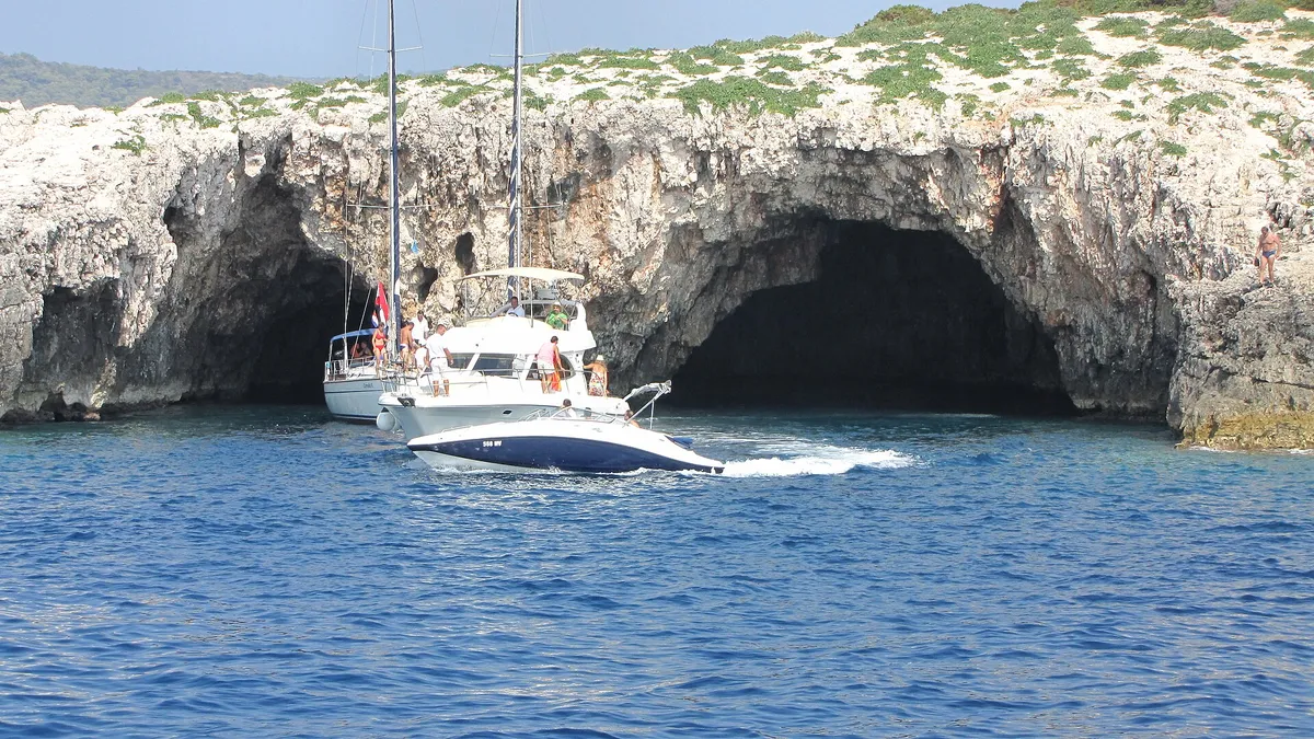
The two sea entrances of the Green Cave on Ravnik seen from the water, a sailing yacht and a motor cruiser at the mouth and a speedboat passingPhoto: “Vis Ravnik green cave - panoramio” by Dejan Sekuloski, CC BY 3.0, cropped and resized

The Green Cave, Ravnik

A sea cave on the islet south of Rukavac, 0.8 NM away (Measured by us, )

How to stop
Gradina Vis d.o.o. also has buoys off Ravnik, at €40 a day in 2026, paid in cash. (From the operator, )
Tickets
€15 an adult and €7 a child of 6 to 12 from 15 Jun to 15 Sep 2026, and €10 and €5 out of season. A ticket lets you stay and swim for up to 10 minutes. (From the operator, )
Queue
HvarBoats’ tour from Hvar stops at the Green Cave on Ravnik from 11:00 to 11:30. (From the operator, )
Rules it out
The Green Cave is on Ravnik's south side, which takes the wind and waves from the south, the county's plan says; by our measure from the chart it also has long open water to the east and west. Boat visits run only when the weather allows. (Official source, )
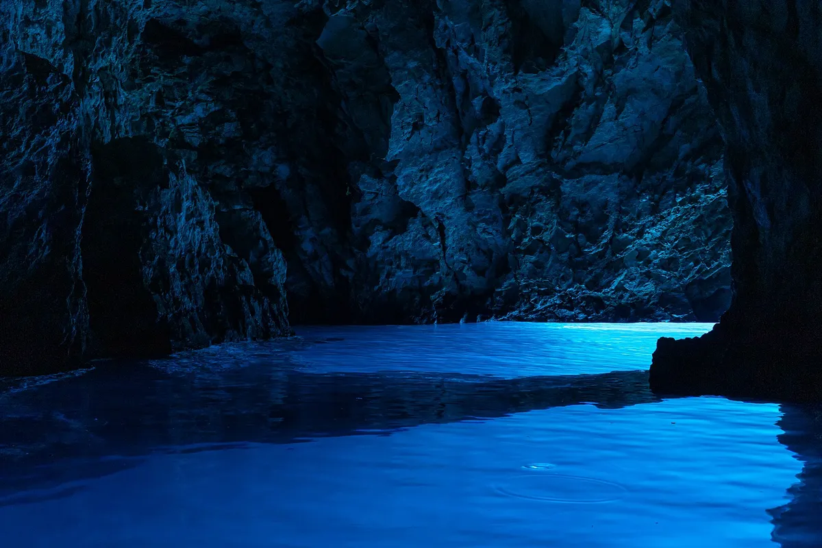
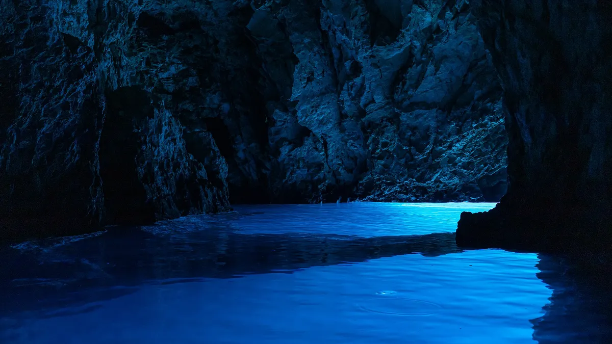
Light glowing blue on the water inside the Blue Cave (Modra špilja)

The Blue Cave, Biševo

A sea cave on Biševo, 5 NM from Komiža (Measured by us, )

How to stop
You leave your boat in Mezuporat bay, which serves the Blue Cave visits, and go into the cave in the operator's boat: the ticket covers one transfer and the visit. The operator's information desk is on the shore. (Official source, )
Tickets
€24 an adult and €12 a child aged 6 to 12 from 20 Jun to 10 Sep, and €18 and €9 from 1 Apr to 19 Jun and 11 Sep to 31 Oct. Under 6 free. Cash, card or bank transfer; the ticket includes the visitor centre's exhibition. (From the operator, )
Opens
Unknown.
Rules it out
Visits run only when the sea and weather allow. (Third-party source, )

Don't miss on Vis

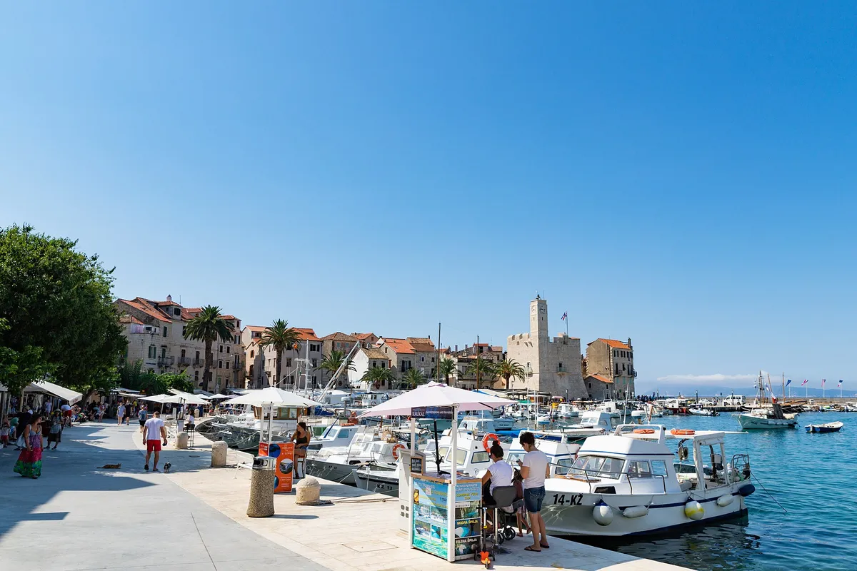
The Komiža waterfront with the Kaštel tower, which holds the fishermen's museum, and local boats along the quay.Photo: “Komiza Town Harbour with a view to the Fishermen's Museum on Vis island, Croatia” by dronepicr, CC BY 2.0, resized

The Kaštel, Komiža

A 16th-century tower on the Komiža waterfront, a short walk from the town quay. Every day 9 am to noon and 7 pm to 9.30 pm, the hours from 1 May 2025 (the Town has posted none for 2026). (From the operator, )

Tito's cave

Tito's cave (Titova spilja), north of the village of Borovik, was Tito's headquarters from June to October 1944, where the Tito-Šubašić agreement was concluded. It is a protected cultural good, register number RST-1303. (Official source, ) Tito's cave, in fact two caves, is reached by a laid stone staircase from the road up to Hum. (Third-party source, )

Where to eat

A konoba is a family-run tavern. Some have a jetty or buoys for guests: see restaurant moorings.

LolaVis town, Matije Gupca 6

Fresh fish and seafood, handmade pasta and Dalmatian dishes in a garden with stone walls and olive trees. Open every evening from 18:00; book for dinner in the garden. (From the operator, )

Konoba Roki FireDol, inland

Meat, fish or octopus slow-cooked for hours under a peka, a bell-shaped lid. Book the peka at least four hours ahead, and ask for the transfer to the restaurant when you book. (From the operator, )

Konoba JastožeraKomiža waterfront

Lobster is the speciality here, cooked several ways, brodetto among them. Call to book. (From the operator, ) More in Komiža

Seven days from Split on a map
Not for navigation

Help keep this page right

Still right? Facts sailors saw still as we say them, by a tap on "Yes, I saw it" or in a dated forum post. Neither changes the fact or its date.

  • The buoy fields in Komiža: 1 sailor, on Reddit,

Sailed here this season? Tell us what you found. We check it with the source before anything changes.

Or confirm one fact: tap the small mark after it, then "Yes, I saw it".

Other ways to help

Photos on this page

  • Sailing yachts anchored off the mouth of Stiniva cove, aerial with open sea and horizonStiniva Bay, south coast of Vis. Photo: “Aerial view of the Adriatic Sea at Stiniva Bay on Vis island in Croatia” by dronepicr, CC BY 2.0, cropped and resized
  • Aerial of Komiža harbour and town, yachts on the pier and at anchor, hills behindKomiža, island of Vis. Photo: “Aerial view of Komiza Town Harbour on Vis island, Croatia” by dronepicr, CC BY 2.0, cropped and resized
  • Kut waterfront in Vis town with yachts and gulets moored and a yacht on a buoy in frontKut, Vis town, island of Vis. Photo: “J32 421 Vis-Stadt, Lučica” by Falk2, CC BY-SA 4.0, resized
  • Komiža bay from the hillside, with boats at anchor in front of the town and the Hum hills behind.Komiža, Vis, the bay. Photo: “Komiža Island Vis” by ModriDirkac, CC BY-SA 4.0, cropped and resized
  • Yachts on mooring buoys in Stončica bay, with the beach and pine slope, seen from the hillsideStončica, east coast of Vis. Photo: “Stoncica beach bay on Vis island, Croatia” by dronepicr, CC BY 2.0, resized
  • Small local boats in the clear turquoise bay at RukavacRukavac, south coast of Vis. Photo: “J32 450 Rukavac” by Falk2, CC BY-SA 4.0, resized
  • The lagoon between Veli Budikovac and Mali Budikovac from the air, yachts on the buoys in turquoise water, the pebble beach and the jetty on Veli Budikovac and open sea beyondThe Budikovac lagoon (Plava laguna), off south-east Vis. Photo: “Blue lagoon at Budikovac island in Croatia” by dronepicr, CC BY 2.0, cropped and resized
  • The white pebble beach of Srebrna bay with clear shallow water, the low rock slabs of the headland and open sea beyondSrebrna bay, south-east coast of Vis. Photo: “SREBRNA - panoramio” by sanja mm, CC BY 3.0, cropped and resized
Show all 15 photo creditsShow fewer photo credits
  • Oključna bay on Vis at dusk, small boats on their moorings in calm water between rocky wooded slopes, the evening sun on the far shoreOključna bay, north-west coast of Vis. Photo: “Uvala Oključna (Porat)” by Emaus78, CC BY-SA 4.0, cropped and resized
  • Yachts and motorboats anchored inside Stiniva cove, straight-down aerialStiniva Bay, south coast of Vis. Photo: “Luftbild von der Bucht Stiniva auf der Insel Vis in Kroatien” by dronepicr, CC BY 2.0, cropped and resized
  • The two sea entrances of the Green Cave on Ravnik seen from the water, a sailing yacht and a motor cruiser at the mouth and a speedboat passingThe Green Cave (Zelena špilja), islet of Ravnik, off south-east Vis. Photo: “Vis Ravnik green cave - panoramio” by Dejan Sekuloski, CC BY 3.0, cropped and resized
  • Light glowing blue on the water inside the Blue Cave (Modra špilja)Blue Cave, Biševo, near Komiža. Photo: “Biševo - Blue Cave - 2021-07-30 11-56-09 2642” by Pierre-Selim Huard, CC BY 4.0, cropped and resized
  • The Komiža waterfront with the Kaštel tower, which holds the fishermen's museum, and local boats along the quay.Komiža, Vis, the Riva and the Kaštel. Photo: “Komiza Town Harbour with a view to the Fishermen's Museum on Vis island, Croatia” by dronepicr, CC BY 2.0, resized
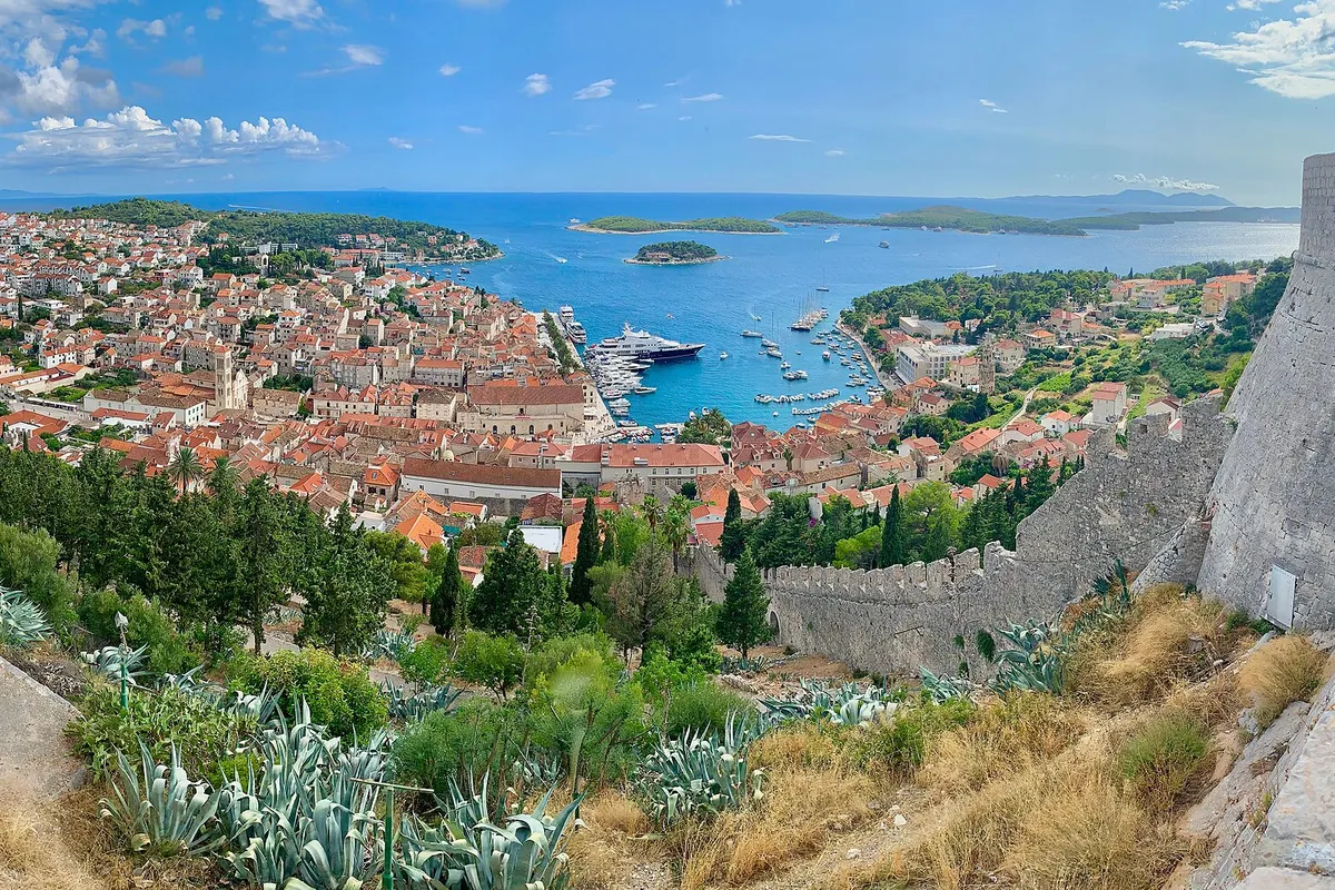
  • Hvar town harbour full of yachts, with the Pakleni islands beyond, seen from the Spanish fortress (Španjola)Hvar town, island of Hvar. Photo: “The Spanish Fortress in Hvar, Croatia” by Steve Jurvetson, CC BY 2.0, cropped and resized
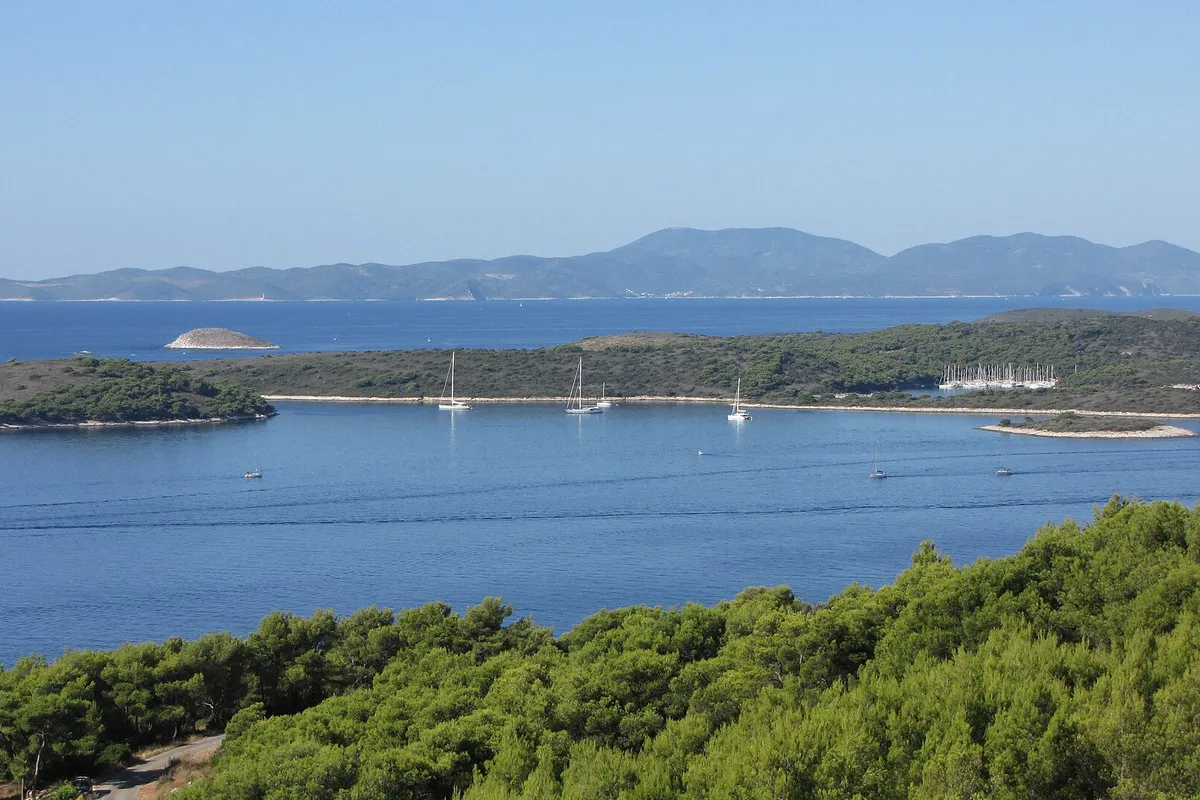
  • The Pakleni islands and ACI Marina Palmižana from the hills above Hvar town, yachts at anchor, Vis on the horizonPakleni islands, off Hvar town. Photo: “Pakleni otoci - panoramio (4)” by Dejan Sekuloski, CC BY 3.0, cropped and resized

Nearby